Clearing Brush: RAF Camping at Clarion

As it turns out, I’d been training all summer for the Recreational Aviation Foundation work party at KAXQ.

Our front yard hosts an absolute tyranny of thistle that springs back into life each year, starting in April and not letting up until the frost hits the pumpkin. Just when I think I have it all pulled, down to the tap roots, a few miscreant spikes push through the mulch and taunt me.

The spines prickle and irritate, so my RAF-issued work gloves have had no less than four sessions already of bending and turning soil and pulling carefully to get the most noxious stuff out.

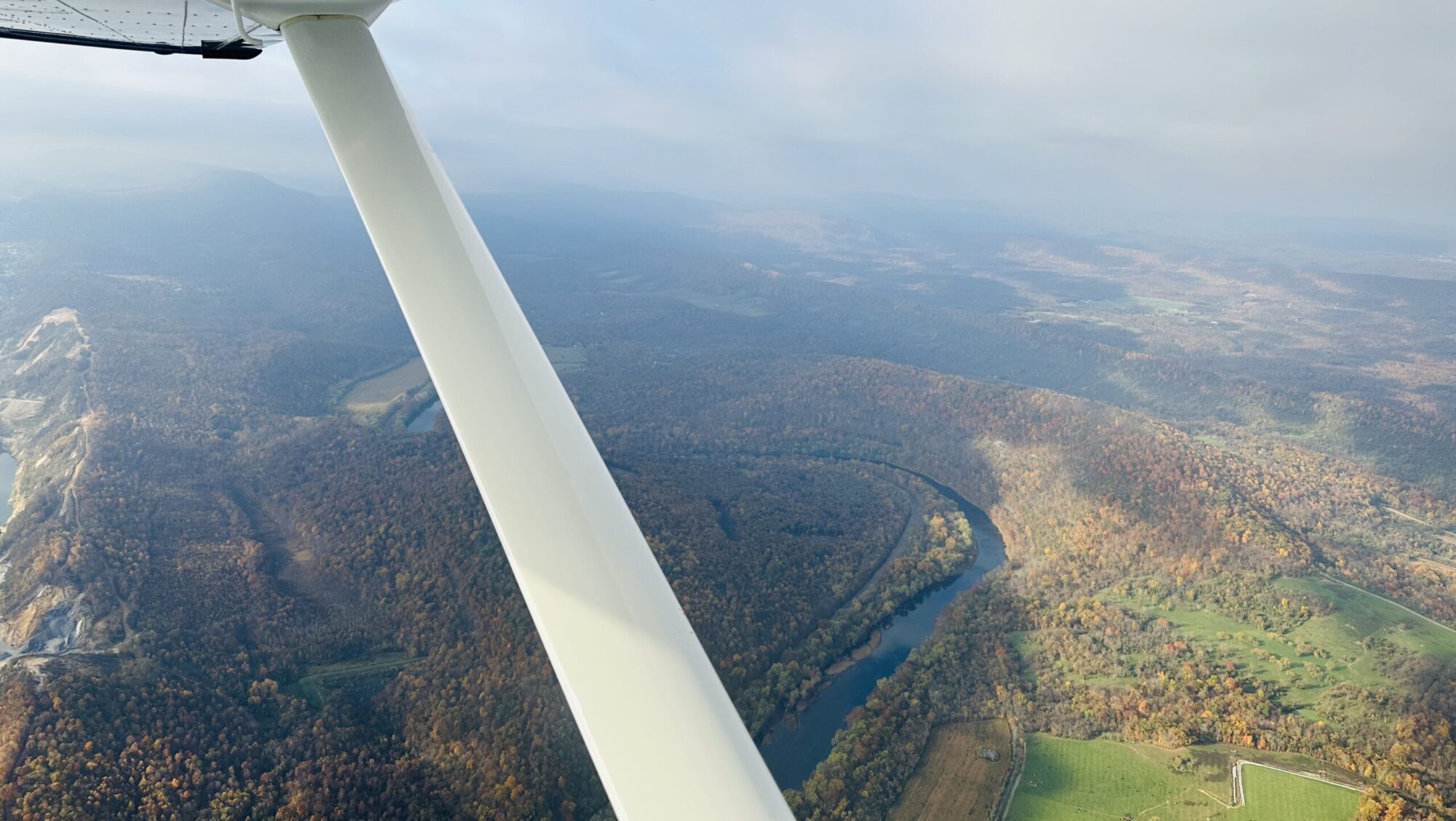
And that’s almost exactly the task assigned to me first when we taxied onto the ramp at Clarion County Airport, in western Pennsylvania. We secured the Cessna 182, walked through the FBO, and saw the wooded entrance to the camping site across the parking lot, not a football field length away.

RAF liaison for PA/WV Chip Vignolini hailed us from behind his truck, and promptly introduced us to co-liaison for PA Andrew Turner and sons Caleb and Josh, who would be working on building a lean-to for firewood, and splitting the logs piled up on the ground nearby. Right on our heels, RAF volunteer Doug Turnbull flew in and parked his Piper Cruiser next to us, and along with us was given the task of clearing the brush along the banks of the pond.

What pond?

You couldn’t see it through the thicket of black locust trees, ragweed, and other scrub that had sprouted up since the last time Andrew and crew had tackled the area. They all had to go. So we rolled up our sleeves, and Stephen grabbed a strimmer (a weed-whacker to non-Brits), and we went to it.

Two hours later, we not only could see the pond, but the area around the bench was clean as a whistle. We took a break from hauling brush to the other side of the camping area and throwing it into the forest, and then S took on his next assignment: grilling lunch. I worked on finding and clearing the trail supposedly circling the area. I found an old tree stand…and a lot of marshy weeds. But with more of S’s strimming work, a semblance of a path came out of the woods.

Round about noon, the burgers and hot dogs were ready on Chip’s portable grill, and everyone took a load off to enjoy the lunch al fresco. The young men had the shelter framed up, placed nearly equidistant from the twin RAF fire rings already in place. All it needed now was the aluminum roof secured and the RAF sign placed at the entrance to the camping area.

And that’s the story of most RAF work parties. You don’t need special skills (though if you have them, you’ll be assigned accordingly), and the most important thing to bring is a great attitude, some perseverance, and a tough pair of work gloves. With just eight folks pitching in, we conquered the task list in just a few hours.

We departed right after lunch to beat the potentially building thunderstorms along the Appalachian spine between KAXQ and our home airport at Hagerstown. Once more, we were spent physically but emotionally filled back up from the shared effort.

As it turns out, the airplane had visited KAXQ before, bringing its owners to explore the biking and hiking trails that thread throughout the forest south of the airport, all the way to the Clarion River.

Upon talking with Andrew and Chip, they filled us in on how unsung the place was, and mostly empty for much of the year. Though the camping area gets good use during the fall, there are still plenty of times when it doesn’t. And they’d love to see more folks take advantage of the easy access from the airport (which has lots of tie-downs, and self-serve fuel) and the quiet natural beauty that surrounds the place.

We’ve joined work parties before, twice at Moose Creek USFS in Idaho, and those strips get a lot of attention. But it’s the ones close by—Clarion is just 120 nm from home for us—that will entice us throughout the year.

They all deserve our loving care.

For more information on these incredible places, check out the RAF’s Airfield Guide. And to find a way you can help the RAF preserve and maintain airstrips and aircraft camping areas around the country, join them here.

LightHawk Flight to Cape May

The sunlight filtered through a high layer of mackerel clouds as we flew towards it—well, really towards southern New Jersey. On an August Friday morning, the skies north of the DC metro area remained relatively quiet, prompting me to tune in Potomac Approach just to hear some back and forth. Stephen was asleep in the right seat; I take that as a vote of confidence that he slumbers so readily while I keep us on course.

We’ve been tapped again for a LightHawk mission, supporting the conservation flying efforts of the nonprofit group I joined as a volunteer pilot last year. We’re building on our mission last year, which was to run GoPros on the wing and on the glareshield to capture the water levels along the Chesapeake Bay and Atlantic shorelines around the DelMarVa peninsula during a king high tide.

On this day we were booked to meet Jim Wright, volunteer photographer for The Nature Conservancy, and provide him lift for shooting the marshlands and barrier islands that pearl along the Atlantic from Sea Isle City to Cape May. He would also check out a handful of dredged islands for their status, and frame up in his lens the new boardwalk at the nature reserve in South Cape May Meadows.

As luck would have it, when we went out the evening before to preflight the Cessna 182 that our friends so graciously let us use, we needed to top up the tires with air. For anyone who has wrestled with the wheel pants and tire stems on the high-wing Cessna fleet, you know this is much easier said than done. After a lot of cursing—and a call to a generous A&P with the local Martin’s flight department who possessed the right fitting for the compressor’s air hose—we sorted out all three wheels. That should improve my landings!

Early Friday morning we topped off fuel at KHGR (avgas is running $5.95/gallon self-serve, which feels joyous) and headed east. Just off Hagerstown, a dancing oil pressure reading had me momentarily concerned but it settled down and appeared to be just the probe—the single most likely thing to fail on the combined Garmin G1000 NXi/Lycoming IO-540 installation.

We met up with Jim at Big Sky Aviation at KMIV, and Stephen headed for the airport café while I settled Jim into the right seat, with his laptop and camera ready to go. It wasn’t his first LightHawk flight by a long shot, so I briefed him on the specifics of the airplane and the flight, and he was delighted that we would be able to open the window all the way once airborne.

We took off for the eastern shore, and popped through a thin, scattered layer of coastal cumulus around 1,500 feet msl (and agl on this part of the state). The coast itself was clear, and it was too early for the banner towers to populate the skies. We headed south, making circles around various points of interest, trying to determine exactly which little spot of sand and sawgrass was the critical one. Fortunately, we had time in the tanks and capture it all just in case.

Once down around Cape May, Jim spied the new boardwalk that sits between the town and the lighthouse, and we made circles there to ensure we got it at every angle. Part of the mission was also to show the juxtaposition and interplay between development and nature preserve, so Jim took a few landscape shots with the town in the foreground and the beach and the wide Atlantic sea stretching out to the east.

The Nature Conservancy’s Jim Wright photographs the southern tip of Cape May, with South Cape May in the distance. [Credit: Julie Boatman]

On our way back to the Millville airport, we had one more point to spot, on the Maurice (pronounced “Morris”) River that weaves back up the Delaware River delta towards the town of Millville. Bluffs line part of the river. For the life of me, I saw no “bluffs,” but perhaps my perspective was skewed by too much time out west. Jim took enough shots to nearly fill his card, and when we landed back at KMIV, he ran out of battery as we were snapping a shot of us in front of the airplane. Impeccable timing to be sure!

Mission accomplished, we bid farewell to Jim—a screech owl expert who has written a book on the amazing birds—and packed up to head west before the chance of thunderstorms blossomed into a certainty. With 4.3 on the Hobbs back at KHGR, we pushed the trusty girl back into her nest, and patted her on the cowl. We collapsed back at home, spent but satisfied.

The LightHawk mission has once again brought meaning to our flying.