LightHawk Flight to Cape May

The sunlight filtered through a high layer of mackerel clouds as we flew towards it—well, really towards southern New Jersey. On an August Friday morning, the skies north of the DC metro area remained relatively quiet, prompting me to tune in Potomac Approach just to hear some back and forth. Stephen was asleep in the right seat; I take that as a vote of confidence that he slumbers so readily while I keep us on course.

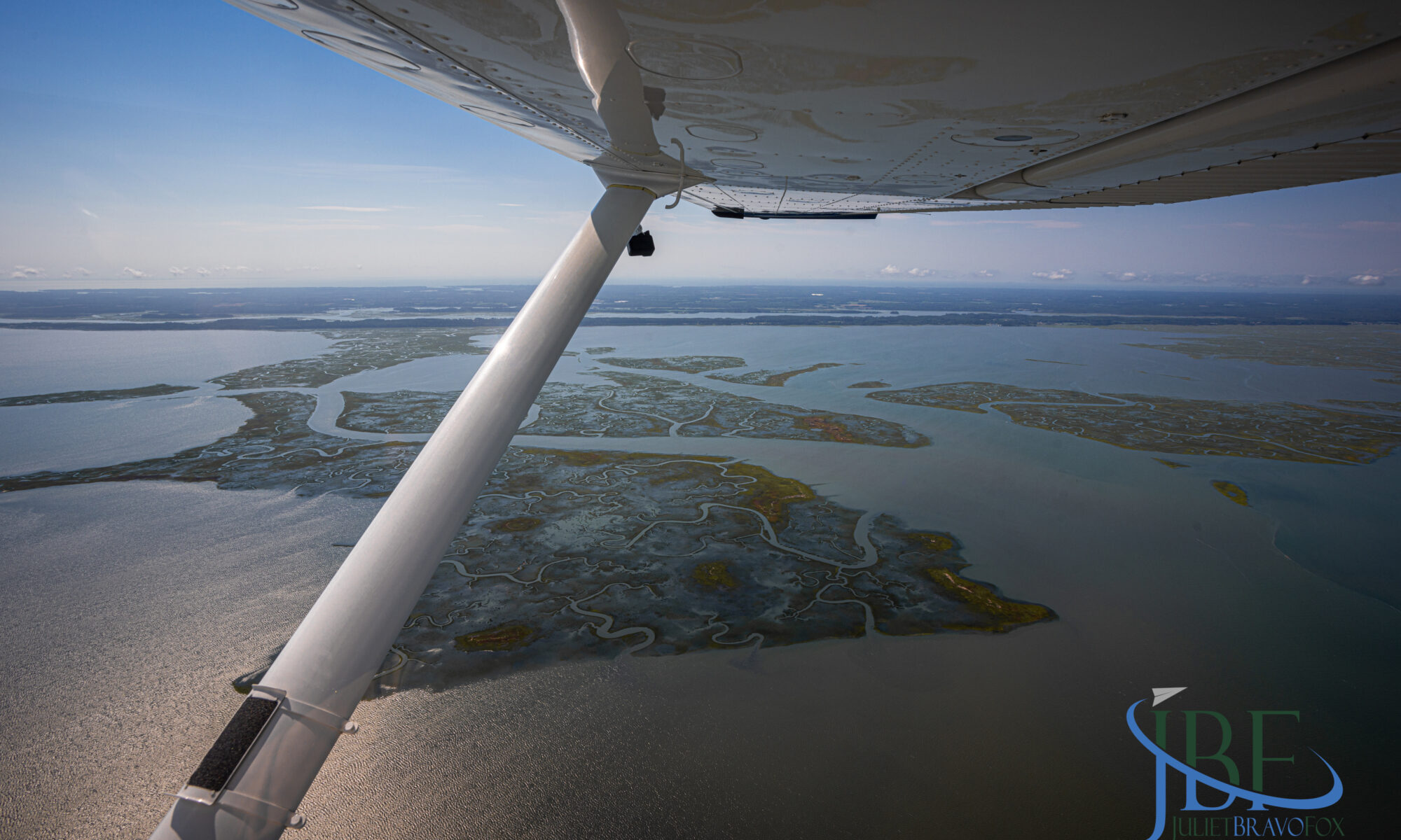
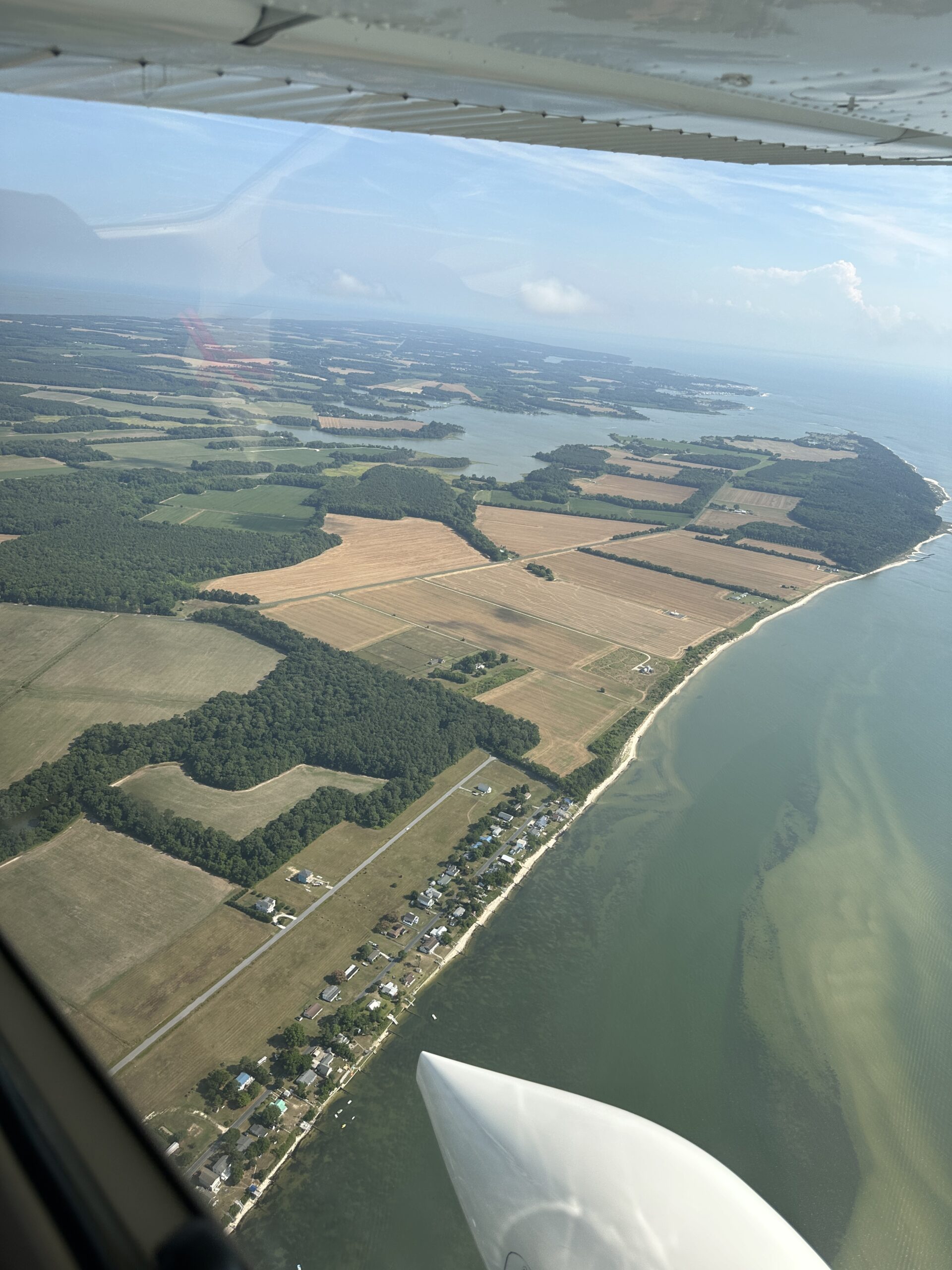
We’ve been tapped again for a LightHawk mission, supporting the conservation flying efforts of the nonprofit group I joined as a volunteer pilot last year. We’re building on our mission last year, which was to run GoPros on the wing and on the glareshield to capture the water levels along the Chesapeake Bay and Atlantic shorelines around the DelMarVa peninsula during a king high tide.

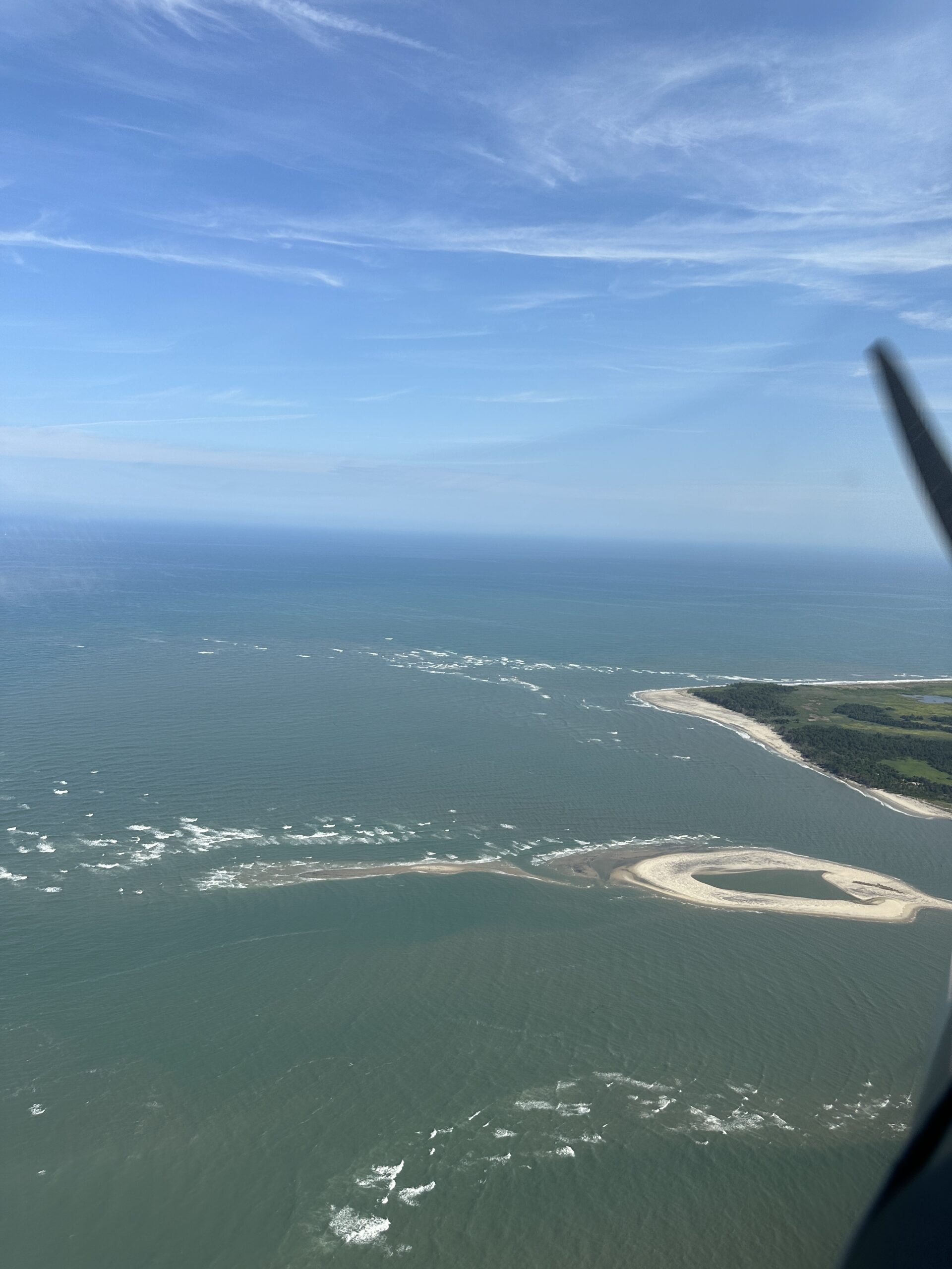
On this day we were booked to meet Jim Wright, volunteer photographer for The Nature Conservancy, and provide him lift for shooting the marshlands and barrier islands that pearl along the Atlantic from Sea Isle City to Cape May. He would also check out a handful of dredged islands for their status, and frame up in his lens the new boardwalk at the nature reserve in South Cape May Meadows.

As luck would have it, when we went out the evening before to preflight the Cessna 182 that our friends so graciously let us use, we needed to top up the tires with air. For anyone who has wrestled with the wheel pants and tire stems on the high-wing Cessna fleet, you know this is much easier said than done. After a lot of cursing—and a call to a generous A&P with the local Martin’s flight department who possessed the right fitting for the compressor’s air hose—we sorted out all three wheels. That should improve my landings!

Early Friday morning we topped off fuel at KHGR (avgas is running $5.95/gallon self-serve, which feels joyous) and headed east. Just off Hagerstown, a dancing oil pressure reading had me momentarily concerned but it settled down and appeared to be just the probe—the single most likely thing to fail on the combined Garmin G1000 NXi/Lycoming IO-540 installation.

We met up with Jim at Big Sky Aviation at KMIV, and Stephen headed for the airport café while I settled Jim into the right seat, with his laptop and camera ready to go. It wasn’t his first LightHawk flight by a long shot, so I briefed him on the specifics of the airplane and the flight, and he was delighted that we would be able to open the window all the way once airborne.

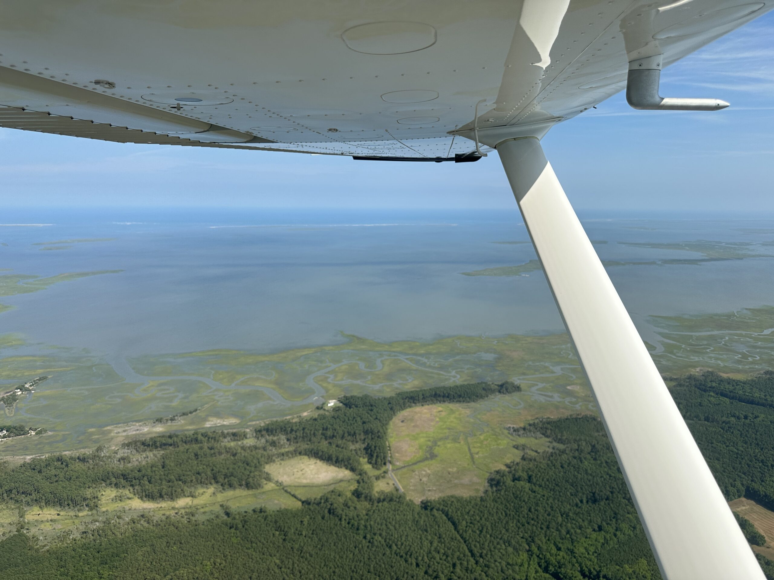
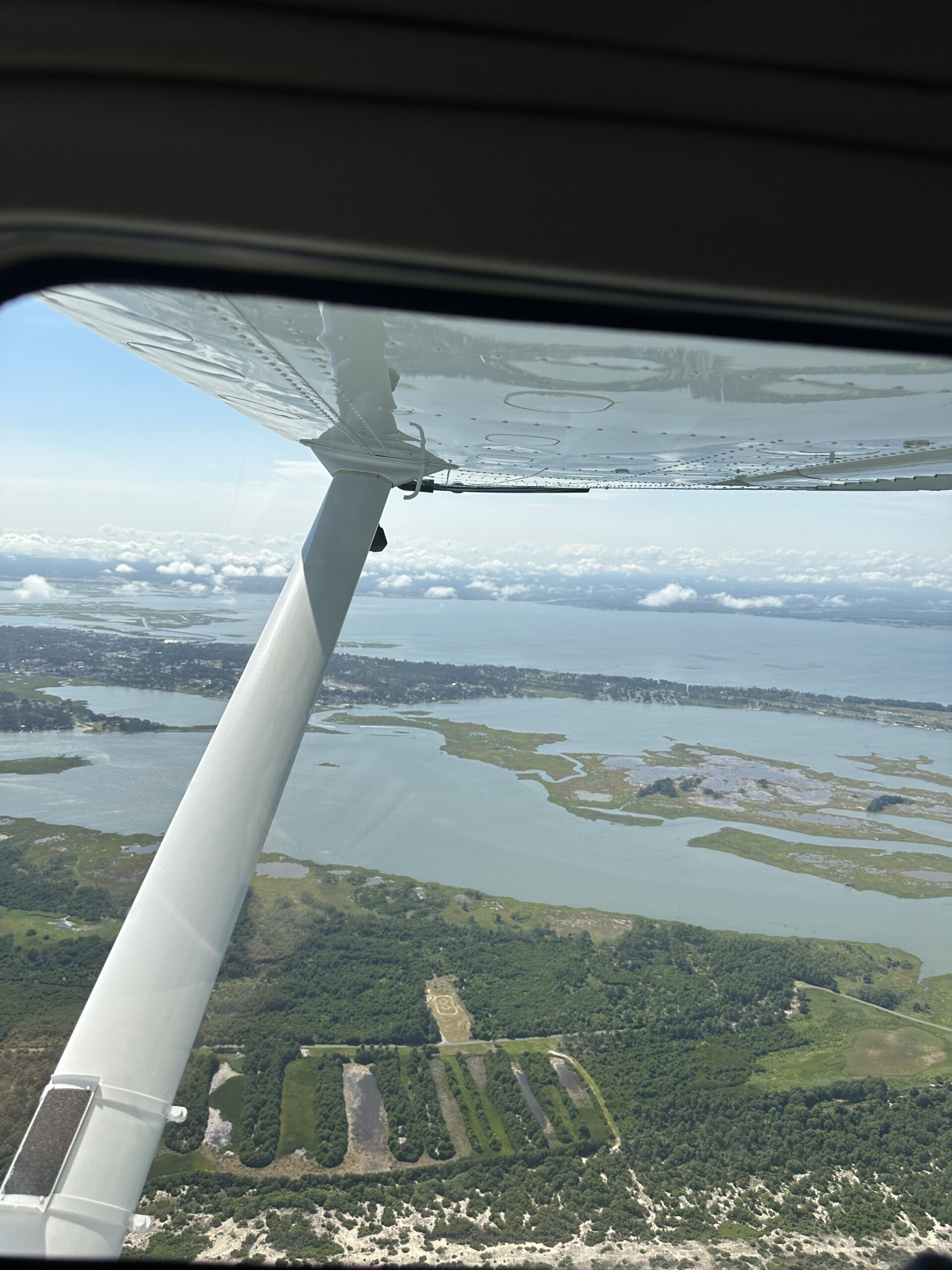
We took off for the eastern shore, and popped through a thin, scattered layer of coastal cumulus around 1,500 feet msl (and agl on this part of the state). The coast itself was clear, and it was too early for the banner towers to populate the skies. We headed south, making circles around various points of interest, trying to determine exactly which little spot of sand and sawgrass was the critical one. Fortunately, we had time in the tanks and capture it all just in case.

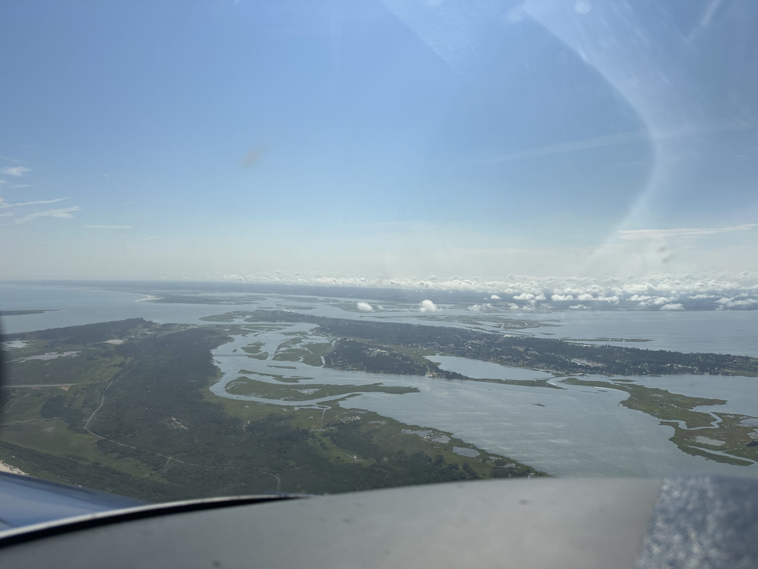
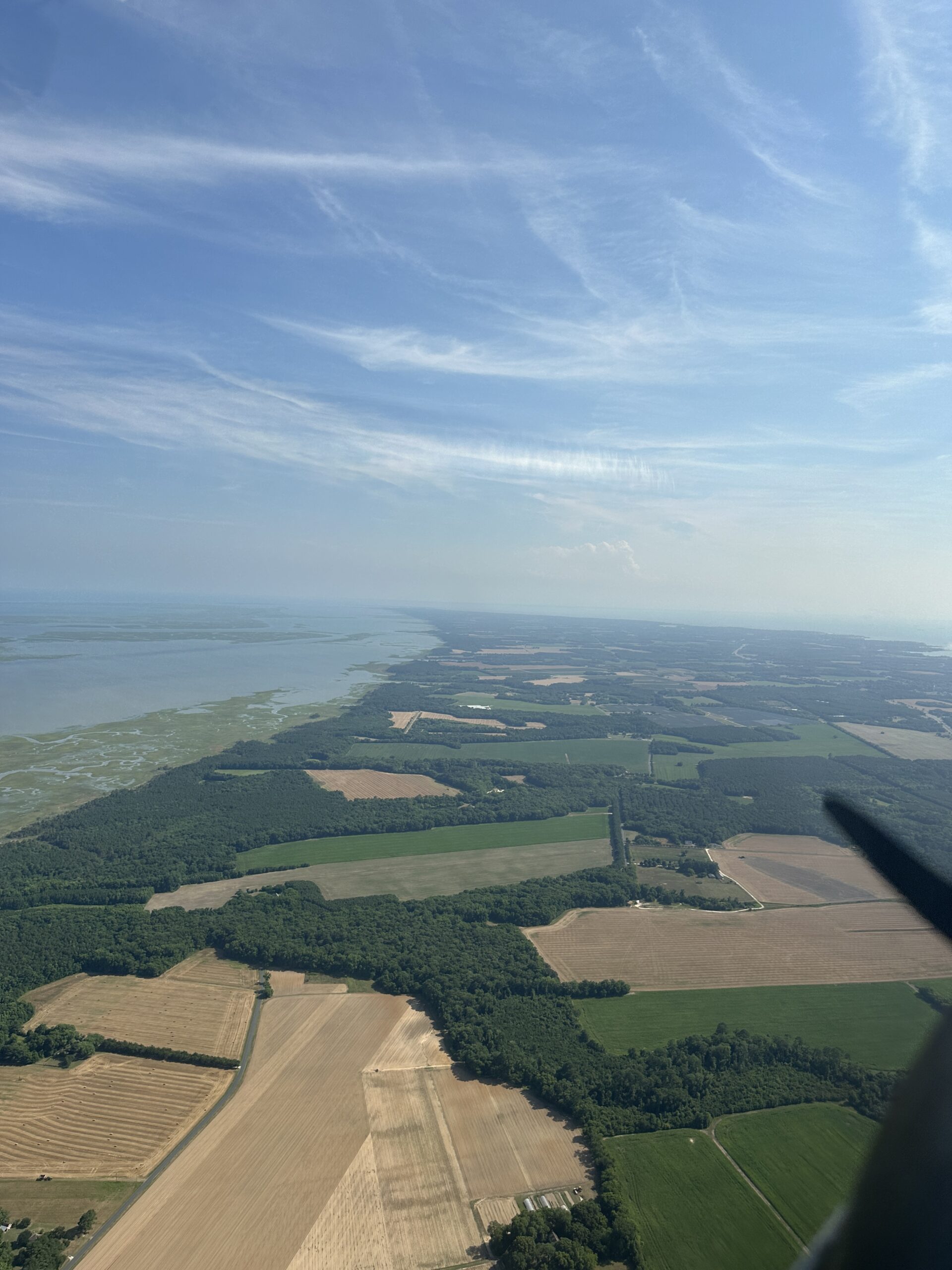
Once down around Cape May, Jim spied the new boardwalk that sits between the town and the lighthouse, and we made circles there to ensure we got it at every angle. Part of the mission was also to show the juxtaposition and interplay between development and nature preserve, so Jim took a few landscape shots with the town in the foreground and the beach and the wide Atlantic sea stretching out to the east.

The Nature Conservancy’s Jim Wright photographs the southern tip of Cape May, with South Cape May in the distance. [Credit: Julie Boatman]

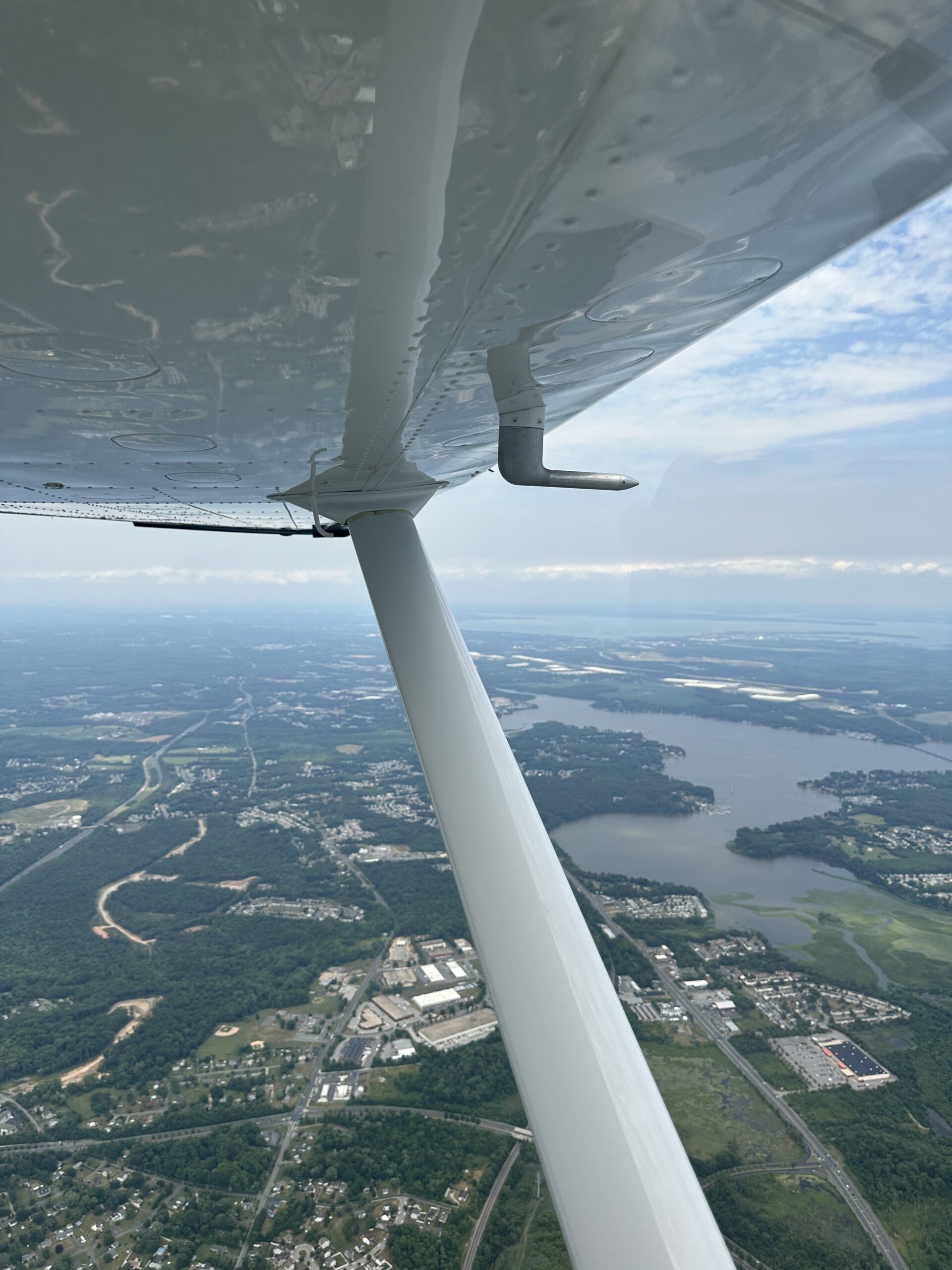
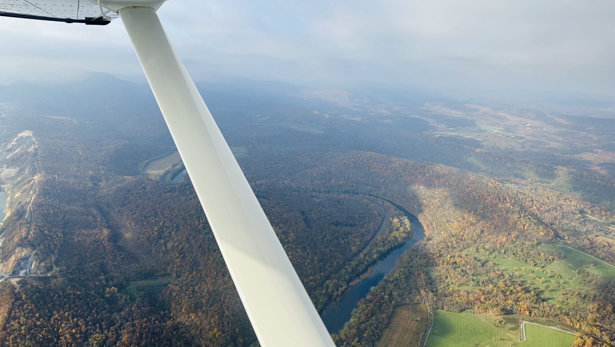
On our way back to the Millville airport, we had one more point to spot, on the Maurice (pronounced “Morris”) River that weaves back up the Delaware River delta towards the town of Millville. Bluffs line part of the river. For the life of me, I saw no “bluffs,” but perhaps my perspective was skewed by too much time out west. Jim took enough shots to nearly fill his card, and when we landed back at KMIV, he ran out of battery as we were snapping a shot of us in front of the airplane. Impeccable timing to be sure!

Mission accomplished, we bid farewell to Jim—a screech owl expert who has written a book on the amazing birds—and packed up to head west before the chance of thunderstorms blossomed into a certainty. With 4.3 on the Hobbs back at KHGR, we pushed the trusty girl back into her nest, and patted her on the cowl. We collapsed back at home, spent but satisfied.

The LightHawk mission has once again brought meaning to our flying.

First LightHawk Mission: High Tides on the Bay

The wind picked up white tips on the wave tops below, little cirrus wisps on a teal-blue field.

Turning south to parallel the Atlantic coast down from Rehoboth Beach, we made good on a promise I’d made myself 4 years ago when we first flew with LightHawk for a story for Flying magazine.

With the pivot to our own business this spring, I saw clearly the gift of time we could now dedicate to volunteering for several aviation organizations near to my heart: the Recreational Aviation Foundation, the Society of Aviation and Flight Educators, and LightHawk. I could spend meaningful time with each, and give purpose to my flying as well as collaborate with some of my favorite folks in the aviation family.

I went through the process to become a LightHawk volunteer pilot (VP), a series of interviews and reflection on my experience, as well as recommendations from key folks I’d flown with the in past. They set a minimum total time of 1,000 hours PIC for a reason: The flights typically involve carrying non-aviation passengers and photographers. The flights may also follow routing at low level and/or in congested airspace, or in varying terrain for the sake of capturing a broad breadth of the natural resources we collectively seek to protect.

Our first mission would just involve Stephen and I, capturing a couple hours’ worth of video of the high tide at the end of June along Maryland’s Atlantic coast and around the Delmarva Peninsula into the Chesapeake Bay. LightHawk will add the reels to their archives, and use them to compare to similar footage to be collected during the King Tides in September. We’d fly our friend Bobbie’s Cessna 182, the perfect steed for this, and test out a couple of new GoPro mounts along the way. It was an ideal one to start for us.

But it wasn’t without its complications. We’d need good VFR weather—no low coastal clouds, and no convection down low bumping us around. We’d also need to navigate the special use airspace peppering the Bay and the southern tip of the peninsula. The length of the mission would stretch our legs (but not the 182’s, with its nearly 6 hours endurance), and the afternoon timing meant we would be flying in the hottest part of the day.

We chose our day: Saturday, June 29. We had to wait for the weather to clear off on the peninsula, and some last-minute fiddling with the tiedown-ring mount on the wing meant we got off a little later than hoped. We’d still make the coast by a few minutes after the high tide mark, but we’d be an hour past that by the time we got to the bay side. C’est la vie! We’d capture what we could and take lessons learned for the next time.

However, we completely lucked out when it came to airspace: the summer weekend with the DC and Delaware areas quiet as far as VIP movements (read TFRs) nixed the one centered on KILG that would have affected the northern part of our route. And, the closed tower at Wallops and cold restricted areas throughout the bay meant we could fly out straight over Aberdeen, down the coast past Chincoteague, cut across the tip as needed, and back up the other side.

We even managed a Class B clearance just north of BWI on the return, giving us a clear view of the Key Bridge (or its remnants) and our best shot at making it back to KHGR before the thunderstorms came over the mountains from the west. Many thanks to those nameless folks at Potomac, Dover, and Patuxent Approach for your help and creative suggestions.

The remote control on the wing mount worked, as we found coming over KGED, and a glareshield mounted GoPro as a backup worked well too. Stephen ran video on his iPhone for triple redundancy. We’re now in the tedious process of uploading all of the footage to LightHawk for their review and consideration.

Regardless of that outcome, we’re calling the mission a success. We clocked 4.1 hours on the Hobbs, and got the airplane back in the hangar before the rain began at the surface.

I figure we managed to generate all four of the “happy chemicals” a person needs to lift their spirits: dopamine (achieving a goal); serotonin (being above nature); oxytocin (helping others); and endorphin (being creative).

LightHawk is in the midst of its #50in50Challenge to launch 50 flights in the 50 days starting from June 15. If you’re interested in becoming a LightHawk VP, check it out here.